Tuesday, February 24, 2009

Virtual Tour

Location ActivityGoogle Earth Content
1. Independence, MO
Answer Question: What would you pack if you were leaving on the Oregon Trail?Terrain, Borders and Labels, Photo 
2. Chimney Rock
Answer Question:  How do you think Chimney Rock got its name?Terrain, Borders and Labels, Photo
3. Fort Bridger
Math activity: trading post

Terrain, Borders and Labels, Photo

4. Oregon City
Journal entry in roleTerrain, Borders and Labels, Photo 
Details of image overlay / path / polygon:Path will connect Independence, MO (start), Chimney Rock, Fort Bridger, and Oregon City (finish). Each point will show photos of each location as they may have looked at the time of the Oregon Trail.


Content:

The content of this lesson is based on the 5th Grade Utah Curriculum, Standard 4: "Students will understand that the 19th century was a time of incredible change for the United States, including geographic expansion, constitutional crisis, and economic growth". I am focusing on Objective 1c, which states "Investigate the significant events during America's expansion and the roles people played....Compare the trails that were important during westward expansion (e.g. Oregon, Mormon, Spanish, California)". This virtual tour will take students to 4 major points along the Oregon Trail, allowing them to see the landscape of each destination as well as the path that pioneers traveled to the west. Students will also engage in various activities at each location.

Technology:

The technology used to create this virtual tour is Google Earth. Students will use computers to view each location with Google Earth, access other websites on the internet for more information, and if possible, type their responses and journal entries on Microsoft Word. Google Earth is a perfect fit for teaching about the Oregon Trail because students can see actual photos of each location and watch the program zoom in and out to see the whole path of the Oregon Trail on a map.

Pedagogy:

This activity will be especially effective for visual and hands-on learners. They will be able to see the places that we learn about as we discuss the Oregon Trail. The activities provided at each stop (journal writing, answering questions, getting more information, etc.) are also good pedagogy because they keep students actively involved and offer various ways for students to process and apply the content that is learned.

Tuesday, February 10, 2009

Tuesday, February 3, 2009

Digital Storybook Storyboard

The content I will use in my digital storybook lesson is based on the Utah Core Curriculum Standard 1, Objective 2 which states that students will "develop language through viewing media and presenting". The story I will present is called "Father Grumble". It follows a rhyming poem structure and can also be presented as a song. I am aiming my presentation at a third grade level because it is a simple story that young students can understand, but it can also invite discussion about deeper themes within the story.

The pedagogy I am using in my presentation is to stimulate the students with a different form of media. This will create variety in my classroom because it is different than the usual reading from a book. I can teach the class as a whole using a presentation of this digital storybook, but I can also divide the class into small groups and teach them how to create one of their own. This is good pedagogy because it gets students directly involved and they can take ownership of their own learning. It fits well with the content of language arts because language is all about communicating with others, and part of the content standard I am trying to fulfill is allowing them to present their stories.

The technology I am using in this lesson is the technological process of creating the actual digital storybook. This involves taking digital pictures of the illustrations, loading them to a computer, collecting background music, recording my own voice reading the story, and then combining visual and audio elements to create the digital storybook. This is a perfect fit for teaching language arts because audio and visual elements are the main focus of a story read-aloud, except technology is used to make it more creative and engaging. I will also teach my students the basic steps for creating digital storybooks and invite them to practice using the technology to create their own presentations in small groups.

Story: "Father Grumble"
Music: "Both Sides of the Tracks" found on Country Vol 4 (freeplaymusic.com)

Storyboard:


Monday, February 2, 2009

TPACK science challenge

1. The content knowledge I am focusing on in this lesson is to fulfill a 3rd Grade standard in the Utah Core Curriculum that deals with the geography of Utah. Third grade science standard 5 states, "Students will understand the physical characteristics of Utah's wetlands, forests, and deserts and identify common organisms for each environment." This is the academic objective that was used to guide the TPACK lesson plan. Beneath that standard, we focused on one specific point of the curriculum that asked the students to "locate examples of areas that have characteristics of wetlands, forests, or deserts in Utah." (Objective 1c). This TPACK lesson plan provided students an opportunity to apply their knowledge of Utah's geography to create a small collection of photo examples using Google Earth. This lesson is intended to follow and expand upon a brief lesson about the characteristics of the landforms so that students know how to find the features they are looking for.

2. The pedagogy used in this lesson involved several good teaching practices. Allowing students to work in small groups gave students the chance to collaborate and build ideas with their peers. It is a good match for the content taught because students can share their understanding with each other, thus benefitting both students. It is also good for promoting the correct use of the technology used in this lesson because students can teach and learn from each other. Using this activity as an assessment tool is also a great pedagogical choice because a teacher can quickly assess the students' understanding of Utah's geography by the pictures they found to exemplify each geographical feature. Presenting the pictures to the class not only helps students develop their presentation skills, but also gives students extra exposure to the content taught.

3. The technology used in this lesson is the program Google Earth and simple screen capturing technology. Google Earth is a natural match to a lesson about geography content because it gives the students the feeling of exploring the world as they use Google Earth to find real-life pictures of geography either in their own local area or somewhere far across the world. This program allows students to see a window to places beyond their classroom walls. Google Earth is also a great match to the pedagogical aspect of group working because it is a great way for students to work together and they will naturally want to share and talk about the pictures and places they find with their peers. Depending on the classroom, limited resources may also require working in small groups at computers instead of individually. Screen capturing technology is vatal to the content and pedagogy involved in this lesson because it allows images to be captured and saved, so that they may later be presented to the class and referred to as examples.

Tuesday, January 27, 2009

The Tech Savvy Teacher


Students used Google Earth to learn geography!


Technology can be a great aid to teachers in all content areas, however often teachers do not know how to apply technology in the content they want to teach. Science, in particular, is a content area that lends itself to using technology to enhance student learning. Recently in my classroom, I discovered a fun and engaging way to teach a 4th grade science standard using Google Earth and screen capturing technology.

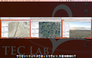
Content Knowledge. The curriculum standard was to apply their knowledge to locate examples of wetlands, forests and deserts in Utah. During the weeks prior to this activity, students learned about characteristics of Utah’s geography, including wetlands, forests, and deserts. The day of the activity, I used a projector to give a brief review to the class of how to use Google Earth. I then distributed a list of geographic features that I had prepared for a scavenger hunt activity. Then, in small groups, the students worked together to search for the scavenger hunt items, which included forests, wetlands, and deserts in Utah. For this activity they were limited to only searching in Utah, but for other activities they search multiple countries.


Students found this picture of a wetland in Utah.

Technological Knowledge. Aside from using Google Earth, students also used other technology skills in this project. After locating each geographic feature on the list, the students used previously taught skills to capture the image on their screen and save it on their computer. These images were shown to the entire class later as examples of the geography that was found. This allowed students to see multiple examples of these geographic features in Utah, without leaving the classroom.


Students discovered this Utah forest using Google Earth.


This desert was found by students to complete their scavenger hunt.

Pedagogical Knowledge. This activity allowed for great teaching methods. Students were working hands on with computers and collaborating in small groups. Students had the opportunity to be creative, and were not restricted to only one right answer. I created a non-competitive environment and gave them sufficient time so they did not rush through the activity, but were able fully participate at their own pace. When they were done finding all the features, I was able to assess their knowledge and understanding of the features by viewing the pictures they captured on Google Earth. The students also were able to share their images with other students at the end to show what they found, and provide more examples of the features to their peers.


Screen capturing technology was used to present the photos students found on Google Earth.

By using technology to teach this science standard, my students were able to become active learners and see a variety of features they were learning about, all in their own state. Incorporating Google Earth and screen capturing in my lesson allowed me to include content, technological, and pedagogical knowledge.

Utah Core Curriculum
4th Grade Science

Standard 5: Students will understand the physical characteristics of Utah's wetlands, forests, and deserts and identify common organisms for each environment.

Objective 1: Describe the physical characteristics of Utah's wetlands, forests, and deserts.

C. Locate examples of areas that have characteristics of wetlands, forests, or deserts in Utah.

Technology Used: Google Earth, Screen Capturing

Monday, January 26, 2009

TPACK

"TPACK" stands for "Technological, Pedagogical, and Content Knowledge". It is possible for teachers to use any combination of these elements when teaching, but the most effective teaching happens when the teacher relies on knowledge from all 3 of these areas. Technological knowledge refers to knowing how to use current technology in the classroom as a teaching tool. Pedagogical knowledge is understanding the art of teaching and how students are most likely to learn. Content knowledge means knowing the material that you are teaching very well. Each of these types of knowledge is important, and by using all of them a teacher can teach content in a way that kids will learn, use, and remember.

After learning about TPACK, we had the opportunity in class to start thinking about a science lesson that we could teach to elementary students using the TPACK method. We explored several different science and math technologies including programs such as Stellarium, Google Earth, temperature technology, etc. I really liked the Google Earth program and I think it could be a great way to teach geography and landforms since it is unrealistic to travel around the world to see the sites in person. My plan is to create an elementary lesson on world geography using some kind of scavenger hunt on Google Earth. I think it will be fun for kids to use this technology to actually see the places with the types of landforms they are looking for, and they will have more fun and remember it better than just reading from a textbook or something.

Monday, January 19, 2009

Week 2

I learned how to do so many things this week! I learned what an "RSS" is, and now I have one. I added a few RSS website update links to this blog over there on the side, but I have 5 of them right now and it's kind of a hassle to have such a long page to scroll down, so I may delete some of them in the future. I already figured out how to make each feed show only one title instead of 5, so that helped. I also learned about Goodreads and Delicious, and I have accounts with both of those now, too (and links on this blog). I feel like I have so many links and then links to my other links, it's like a web! It's like the world wide web. Haha, sorry. But anyway, I think all of these resources will be valuable to me as a teacher and it's probably good that I'm learning how to use them. So those are my new additions for this week: the RSS feeds, Delicious links, and Goodreads.