
Students used Google Earth to learn geography!
Technology can be a great aid to teachers in all content areas, however often teachers do not know how to apply technology in the content they want to teach. Science, in particular, is a content area that lends itself to using technology to enhance student learning. Recently in my classroom, I discovered a fun and engaging way to teach a 4th grade science standard using Google Earth and screen capturing technology.
Content Knowledge. The curriculum standard was to apply their knowledge to locate examples of wetlands, forests and deserts in Utah. During the weeks prior to this activity, students learned about characteristics of Utah’s geography, including wetlands, forests, and deserts. The day of the activity, I used a projector to give a brief review to the class of how to use Google Earth. I then distributed a list of geographic features that I had prepared for a scavenger hunt activity. Then, in small groups, the students worked together to search for the scavenger hunt items, which included forests, wetlands, and deserts in Utah. For this activity they were limited to only searching in Utah, but for other activities they search multiple countries.

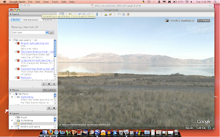
Students found this picture of a wetland in Utah.
Technological Knowledge. Aside from using Google Earth, students also used other technology skills in this project. After locating each geographic feature on the list, the students used previously taught skills to capture the image on their screen and save it on their computer. These images were shown to the entire class later as examples of the geography that was found. This allowed students to see multiple examples of these geographic features in Utah, without leaving the classroom.

Technological Knowledge. Aside from using Google Earth, students also used other technology skills in this project. After locating each geographic feature on the list, the students used previously taught skills to capture the image on their screen and save it on their computer. These images were shown to the entire class later as examples of the geography that was found. This allowed students to see multiple examples of these geographic features in Utah, without leaving the classroom.

Students discovered this Utah forest using Google Earth.

This desert was found by students to complete their scavenger hunt.
Pedagogical Knowledge. This activity allowed for great teaching methods. Students were working hands on with computers and collaborating in small groups. Students had the opportunity to be creative, and were not restricted to only one right answer. I created a non-competitive environment and gave them sufficient time so they did not rush through the activity, but were able fully participate at their own pace. When they were done finding all the features, I was able to assess their knowledge and understanding of the features by viewing the pictures they captured on Google Earth. The students also were able to share their images with other students at the end to show what they found, and provide more examples of the features to their peers.
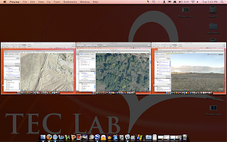
Screen capturing technology was used to present the photos students found on Google Earth.
By using technology to teach this science standard, my students were able to become active learners and see a variety of features they were learning about, all in their own state. Incorporating Google Earth and screen capturing in my lesson allowed me to include content, technological, and pedagogical knowledge.
Utah Core Curriculum
4th Grade Science
Standard 5: Students will understand the physical characteristics of Utah's wetlands, forests, and deserts and identify common organisms for each environment.
Objective 1: Describe the physical characteristics of Utah's wetlands, forests, and deserts.
C. Locate examples of areas that have characteristics of wetlands, forests, or deserts in Utah.
Technology Used: Google Earth, Screen Capturing
This is such a great activity! Using Google Earth is a great way to incorporate technology into your lesson.I would like to use this lesson in my class someday!
ReplyDeleteI really enjoyed your lesson. I think the idea of using a scavanger hunt is amazing! I would definately like to use this lesson someday!
ReplyDeleteWow Violet, your pictures and captions are so impressive! you really are a tech savy teacher!
ReplyDelete